Fireweb GIS
SYW.io (Spinning Your Web (Pty) Ltd) needed to add spatial visualisation and interactivity to their Fireweb platform (https://syw.io/fireweb.html) and ultimately to their Uniti platform (https://syw.io/uniti.html) as well.
Overview
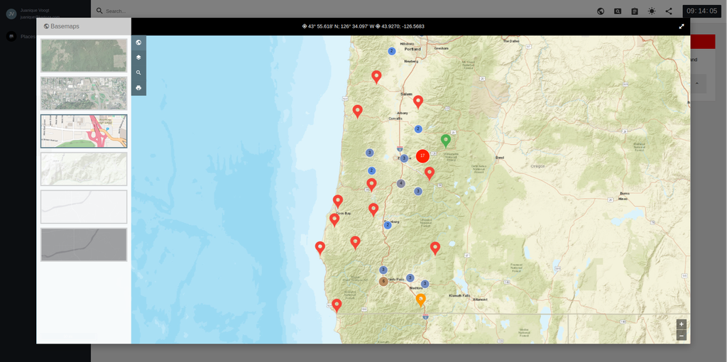
Fireweb is a commercial subscription platform in production with South African and US (Oregon) clients. It facilitates and supports operations around wildfire response and at present is mainly text-based, with a basic map viewer. SYW.io, a commercial subscription platform used for wildfire response, currently primarily text-based with a basic map viewer, requires enhanced spatial visualization and interactive capabilities.
The project was an integration of spatial visualization and interactivity into SYW's Fireweb platform. The project began in 2020, it details the proposed project's need, goals, objectives, mission, operational concepts, assumptions, risks, constraints, authority/responsibilities, and next steps.
The primary goal was to implement initial GIS functionality before the end of the US fire season in November 2020. The broader objective was to integrate richer spatial data and functionality into Fireweb. The project aimed to enable SYW customers to leverage their own, third-party, and SYW-hosted spatial data within Fireweb to support their operational requirements. This is particularly important for customers in regions like Oregon, who host their own web map services.

Project Timeline
Clients
—


