Jakarta Flood Maps
The Jakarta flood maps project aims to identify and visualise flood-prone areas within the city to improve disaster preparedness and response.
Humanitarian Openstreetmap Team (HOT)
Overview
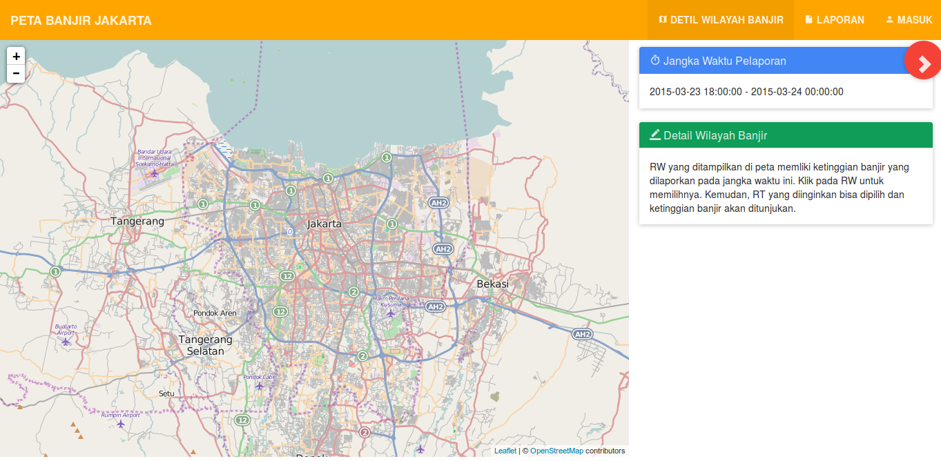
Kartoza developed this application for information gathering and dissemination relating to flooding within the metropolitan area of Jakarta to RW/RT (suburb/block) level. By analysing data on rainfall and topography, the project helps inform urban planning and enhance community resilience against flooding. The platform has a REST API and can generate various reports.
Services Provided
- Development


