Global Command and Control Technologies - GC2T
Kartoza was contracted by Global Command and Control Technologies (GC2T) to help with updating their new mapping software and maps for their older software.
Overview
GC2T had developed a robust desktop and mobile platform called Chaka, designed for critical missions involving situational awareness, vehicle tracking, and operational command and control. The client was struggling with a core component of their offering: reliable, high-quality map and spatial data. They required expert assistance in sourcing, preparing, and managing vast amounts of geospatial data (from recent satellite imagery and topographic vector data to ensuring seamless data flow to rugged field PCs). Their operations required compliance with rigorous military standards.
Kartoza submitted a tailored proposal for specialised Map and Data Support, with a focus on normalising and managing GC2T's core geospatial assets.
The key areas of focus included:
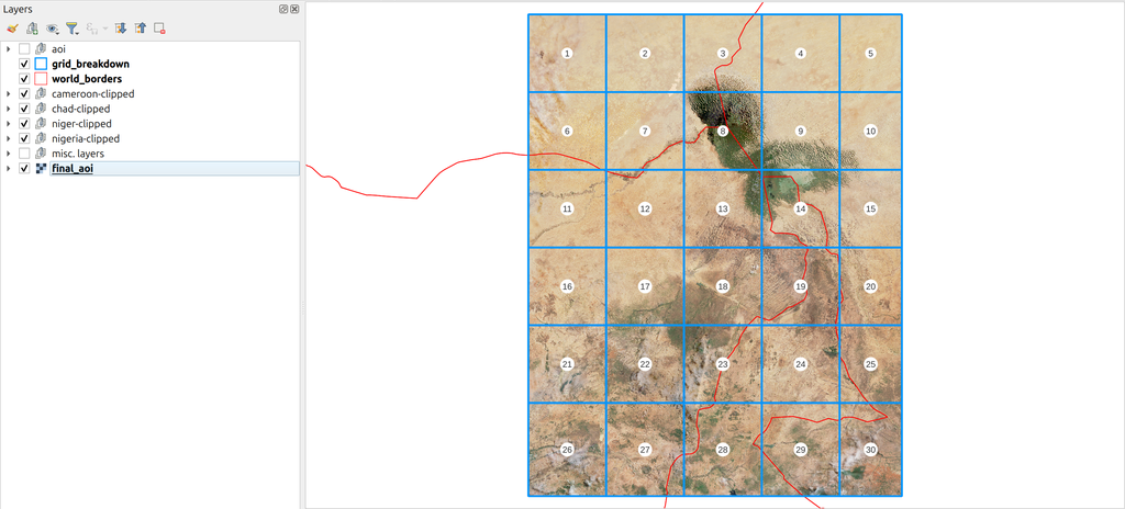
- Data Sourcing and Preparation: Proactively acquiring and processing recent, high-quality aerial and satellite images and complex topographic and vector data for the current operational area in the Lake Chad region.
- Mission-Critical Cartography: Developing and applying advanced cartography, styling, and symbology, specifically implementing Military standard symbols from the MIL-STD-2525 symbol set to ensure map products met stringent operational requirements.
- High-Performance Map Products: Preparing lightweight, performant map data products, such as vector tiles, optimised for fast and reliable use on field devices running the Chaka platform.
- Platform Development Support: Offering C++ and Python development expertise, backed by deep experience with the QGIS API, to assist with core Chaka and related development tasks.
Key Deliverables:
- Updated Maps for Chaka 4 and 5.
- Updates to Chaka 5.
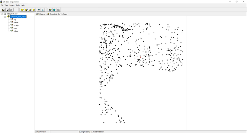
Image 1: Example points in Chaka4


