Zonehaven Support
Zonehaven is an evacuation management platform that helped first responders and communities coordinate and communicate during emergencies such as wildfires. Kartoza provided SLA-based support for the platform’s open-source geospatial infrastructure, ensuring system stability, performance, and reliable data management.
Overview
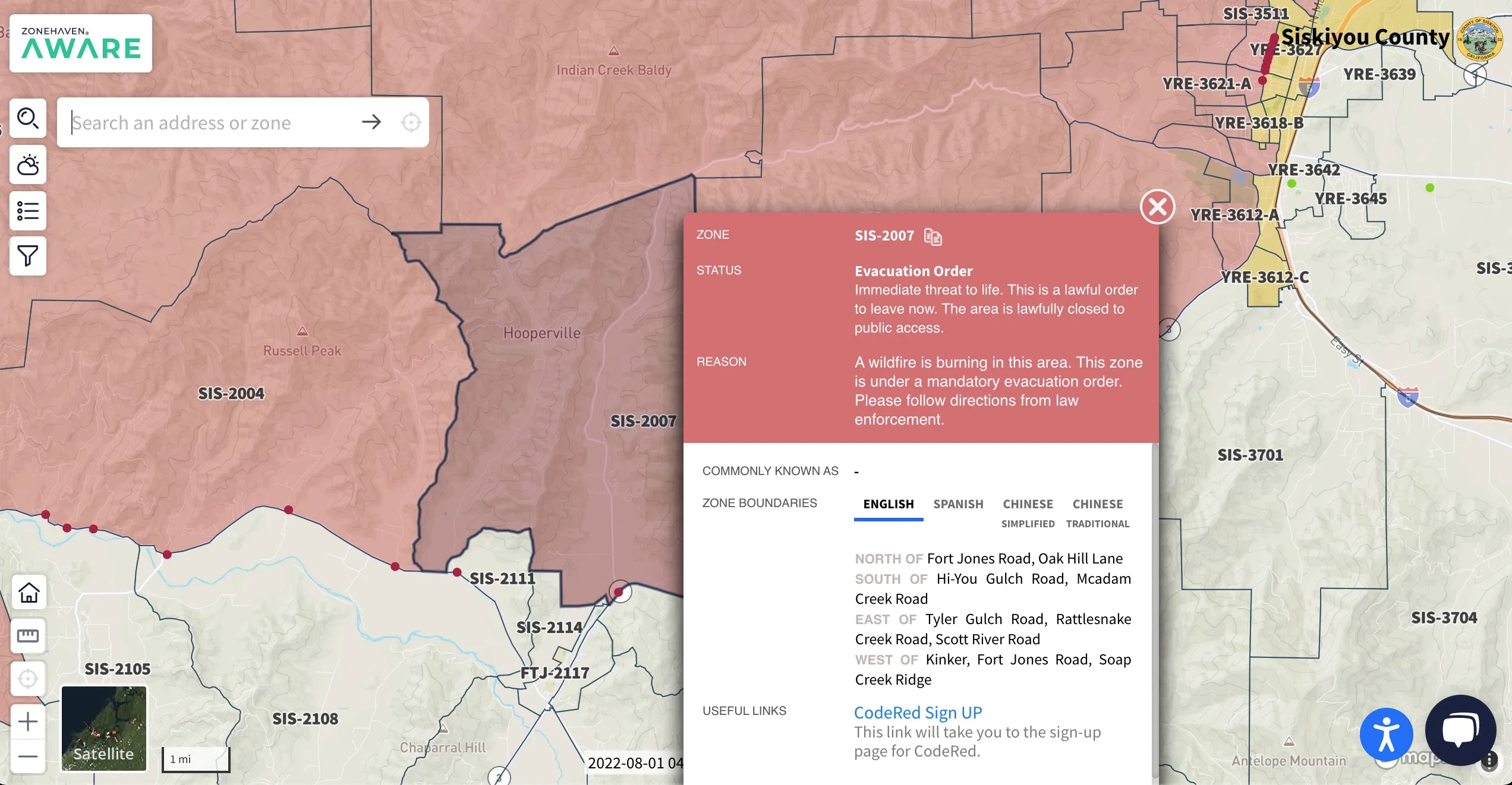
Zonehaven, now known as Genasys Protect, is a mission-critical evacuation management platform used by first responders and emergency managers to coordinate evacuations and communicate clearly with the public during disasters such as wildfires. The platform divided communities into clearly defined zones, enabling authorities to issue targeted evacuation notices and provide real-time status updates that were easy for residents to understand and act on.
Kartoza provided ongoing, high-level Service Level Agreement (SLA) support to ensure the stability, reliability, and performance of Zonehaven’s geospatial infrastructure. This partnership allowed Zonehaven to confidently operate on a flexible, open-source technology stack, with expert support available for configuration, troubleshooting, upgrades, and operational guidance.
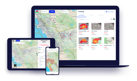
Kartoza’s support covered the full geospatial stack underpinning the platform, including PostgreSQL/PostGIS databases, QGIS Server, GeoServer, MapServer, GeoNode, and core GIS libraries such as QGIS Desktop, GDAL/OGR, and GRASS GIS. Services were delivered through a dedicated support desk with guaranteed response times and included installation and upgrade guidance, data management advice, and GIS consultancy to help maintain a robust and scalable emergency response system.
Project Timeline
Clients
—


